LABS
Terramonitor Labs is our R&D function. We collaborate with the Labs department on large scale projects with research consortiums and research institutions, but also with customized services for private companies. We have a high expertise in utilising optical satellite data and combining it with other data sources.
Here are some references of the Labs projects
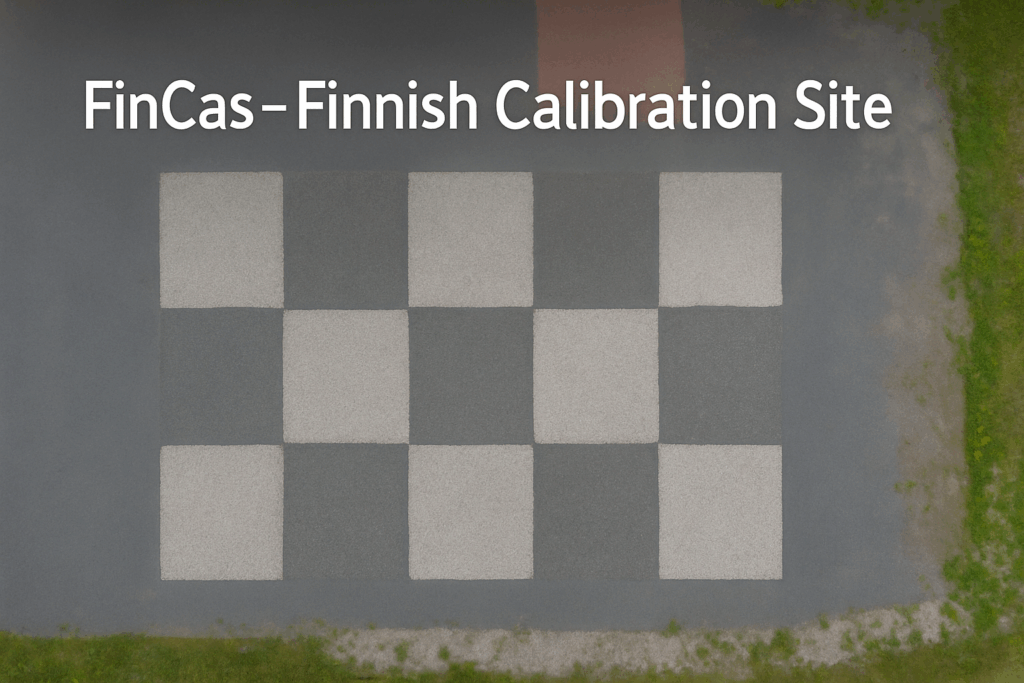
FinCas
The Finnish Geospatial Research Institute (FGI), part of the National Land Survey of Finland (NLS) and Terramonitor have launched the FinCas- Finnish Calibration site project funded by the European Space Agency (ESA). The aim of the project is to define satellite data calibration and validation (cal/val) site requirements for future establishment. The project is carried out during 2025-2026.
Forest DTC
Terramonitor is a subcontractor in the Forest Digital Twin Component project funded by the European Space Agency ESA and led by the VTT Technical Research Centre of Finland. The project will develop the European Digital Twin Destination Earth (DestinE) platform and carried out 2024-2026. Terramonitor is responsible for the technical integration and implementation of the project for the digital twin platform under development. Read more: https://www.foresttwin.org/
Green Calibration
Terrestrial calibration sites are used for calibration and quality assurance of all high-resolution satellites. Using calibrated satellite images significantly increases the accuracy of satellite-based analysis related to climate change, biodiversity loss and carbon sequestration.
The goal of the Green Calibration project is to design and deploy an automated calibration site and to perform an accuracy assessment of the technology in Southern Finland. Read more about Green Calibration

SatNetMonitor
SatNetMonitor increases efficiency in network maintenance and improves the reliability of electricity networks. Cloud based SatNetMonitor gives the network owners a new way of securing the network operation, speeding up troubleshooting, anticipating maintenance needs, preventing incidents, and detecting additional structures in and around the network. In extreme situations like storms, the system enables to see fast the immediate changes in the vegetation close to the network.
FOREST CARBON MONITORING AND FORESTRY TEP
The Forest Carbon Monitoring (FCM) project developed and implemented a prototype of a reliable and cost-efficient monitoring and accounting platform for forest carbon stock based on satellite remote sensing approaches supported by in-situ datasets. Following the first FCM project the project has continued with second phase where Terramonitor is developing and implementing satellite data processing tools for Forestry TEP-platform https://f-tep.com/
HEDIMED – H2020
HEDIMED is a medical project that deals with Immune-mediated diseases (IMD). Our role in the project is to provide data and study, based on satellite data, how and what kind of effects our environment can have on these diseases. The Project is led by University of Tampere together with 19 other consortium members from Europe. Project is funded by the European Commission and takes place in 2020-2025.
ASSESSCARBON- FORESTRY TEP
Assesscarbon project developed and demonstrated at a pre-operational level an approach for large area forest biomass and carbon modelling in Forestry TEP, combining ground reference data, Sentinel-2 imagery and primary production modelling.
GLOBORMAP – EUREKA
The consortium members will combine their technologies, expertise and data to develop a platform for producing global, live, boreal forest inventory and maps from satellite data. Terramonitor is a developing a satellite data workflow to be used further analysing by the other consortium members in Canada and Finland.
INNOVATION PROJECT – METSÄHALLITUS
Metsähallitus, “Forest Administration” is a state-owned enterprise responsible of managing the Government owned forests and land in Finland. In the Innovation project Terramonitor acts as a Space Data provider for the main contractor CollectiveCrunch Ltd that provide more accurate forest inventory information crunching multiple data sources.
SATNET – ESA SMART GRIDS
In the SatNet project Terramonitor acts as a strategic subcontractor to HeadPower Oy. HeadPower and Terramonitor are developing new services for electricity distribution companies (TSO and DSO) based on a Earth Observation data from satellites. The project is funded by European Space Agency.
FORESTRY CHANGE DETECTION – FINNISH GOVERNMENT
In the project Terramonitor developed and piloted Sentinel-2 based forest logging detection tool for Finland’s Forest Centre. The technology was tested and proved to be most accurate and comprehensive tool in Finland. The project was funded by Ministry of Agriculture and Forestry.
SHRUB MAPPING – ESA
In the Shrub Mapping project, funded by ESA, Terramonitor acted as a main contractor of developing a Copernicus data based harmful shrubs detection service for forestry. As a result Terramonitor published the first satellite data based service for seedling stand management in 2019.
COPERNICUS Business Incubation
Terramonitor was the first Finnish company to be chosen to Copernicus incubation as a result of a successful European Space Agency (ESA) business incubation program. Copernicus program supports the most innovative and commercially promising business applications based on Copernicus data and services. The program was funded by the European Commission