Satellite imagery has value for forestry, land-cover monitoring, and environmental analysis, but anyone who has worked with raw Earth observation data knows that getting from imagery to usable results is rarely simple. Different band resolutions, cloud and shadow detection and the requirement for radiometric consistency across seasons and satellites make data preprocessing a demanding step before reliable analysis can begin.
That is exactly the challenge the Terramonitor Sentinel-2 Analysis-Ready Mosaic service is designed to solve.
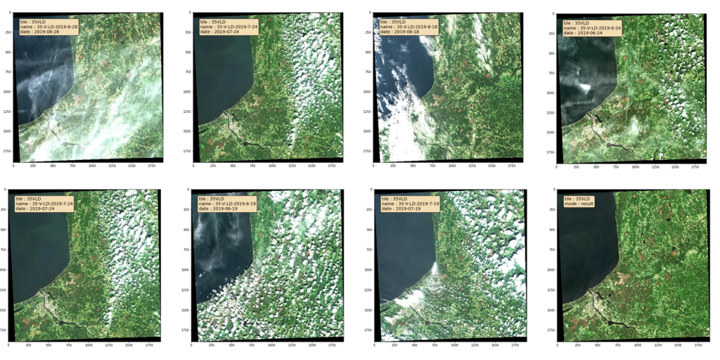
Built as a Docker-based processing component, the service generates cloud-minimized, analysis-ready Sentinel-2 mosaics for forestry and land-cover applications. Instead of forcing users to manually gather, filter, and combine multiple satellite scenes, the service automates the process by ingesting Sentinel-2 Level-2A surface reflectance imagery and harmonizing multiple acquisitions into a single mosaic for one Sentinel-2 tile across a user-defined time period.
This means users can move faster from data collection to actual analysis. The processing workflow applies cloud filtering based on image metadata, performs pixel-wise temporal compositing, and produces a spatially consistent raster mosaic that is ready for visualization, GIS workflows, and downstream analytics. In practical terms, the service helps remove a major bottleneck in remote sensing: the time and technical effort required to turn a stack of satellite scenes into a reliable, usable dataset.
One of the key strengths of the service is its focus on scalable operational use. It is optimized for execution within the F-TEP infrastructure, making it suitable not only for single runs but also for repeated or batch processing across large forested areas. That makes it especially relevant for organizations that need consistent, repeatable Earth observation products rather than one-off image preparation.
The service is also flexible in how processing can be configured. Users define the Sentinel-2 tile, the time range for image selection, the maximum acceptable cloud coverage, the minimum data coverage, the required median number of valid observations per pixel, the bands to include, and the final output resolution. This parameter-driven approach allows the same service to support a range of forestry and land-cover use cases while keeping the workflow standardized and efficient.
The result is a single, cloud-minimized, analysis-ready mosaic that can be used directly for applications such as vegetation monitoring, change detection and carbon assessment. Because the output is already prepared for GIS and EO analytics, teams can spend less time on preprocessing and more time extracting value from the data.